
|
|
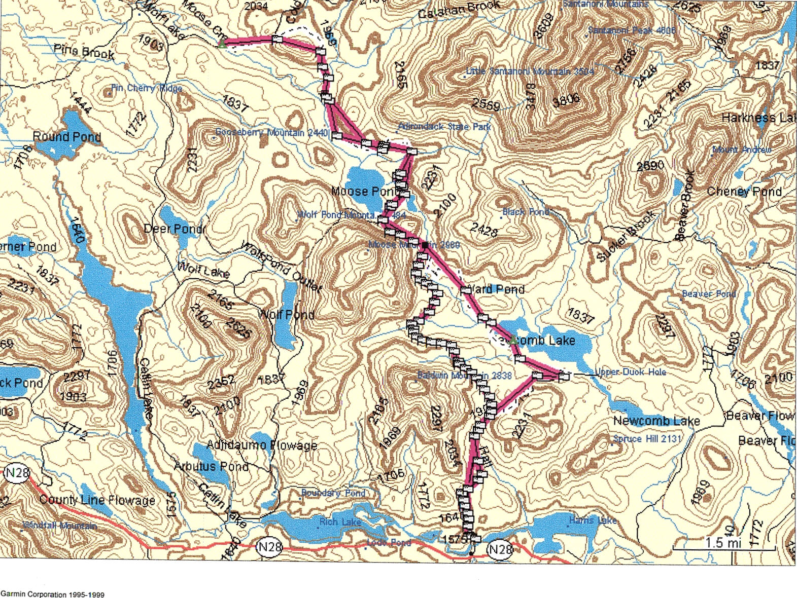
This map was made using Garmin Mapsource US Topo maps software, and downloading my actual track logs from the Garmin etrex handheld GPS unit I took along. I couldn't figure out how to (I don't think you can) output a map to a graphics file, so I printed and scanned it in for now. Well, the route I took in starting at the south (bottom) side of the map. On the way into the Moose Pond Stream Lean-Tos, I used the foot trail along the south side of Newcomb Lake. And the route out, which used the horse trail all the way, is to the west of the trail in. This was a little shorter and much easier walking.
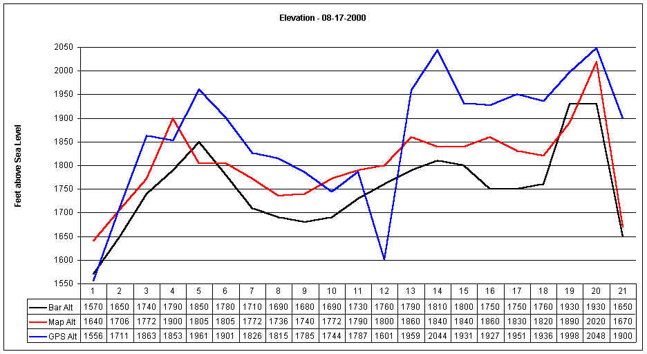
Since I have too much time on my hands, I made a table of all the waypoints, and compare the GPS elevation (GPS Alt) with the Suunto elevation (BAR Alt) with the map elevation (Map Alt). From this, it looks like the Suunto has a more reliable readout.
|
|
|