Saturday morning I left about 8:00. My first challenge was a beaver dam flood around the NW edge of Middle Settlement Lake. The trail had been rerouted, but was still a little tricky. In this part of the forest the leaves were 80-90% down.
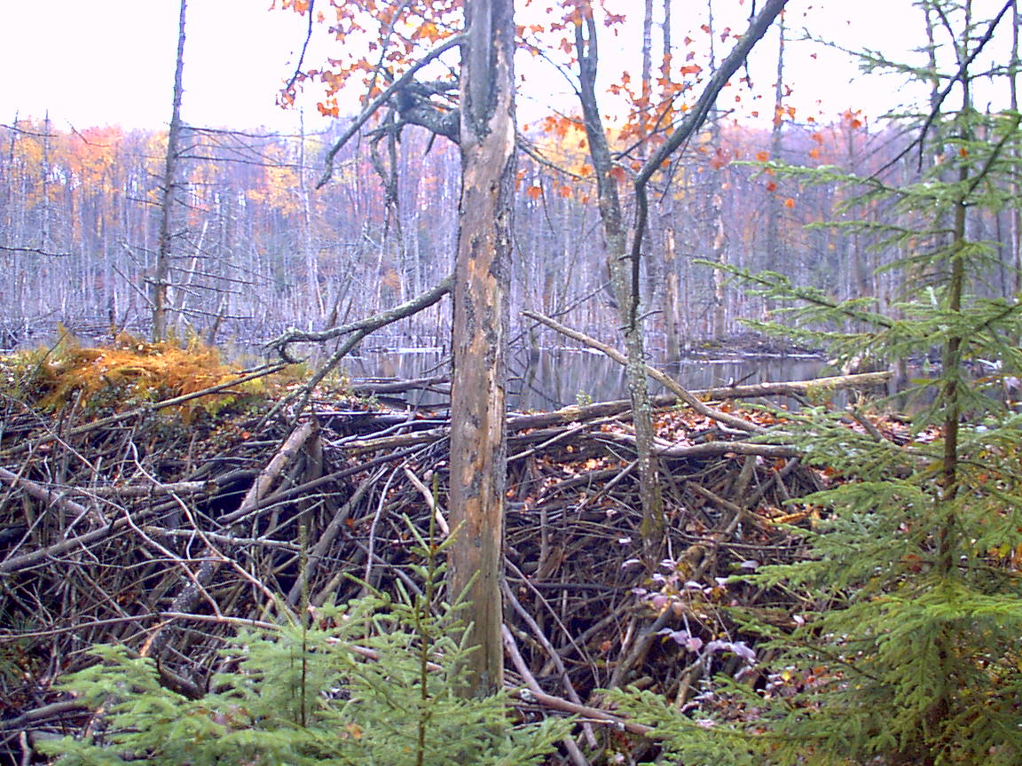
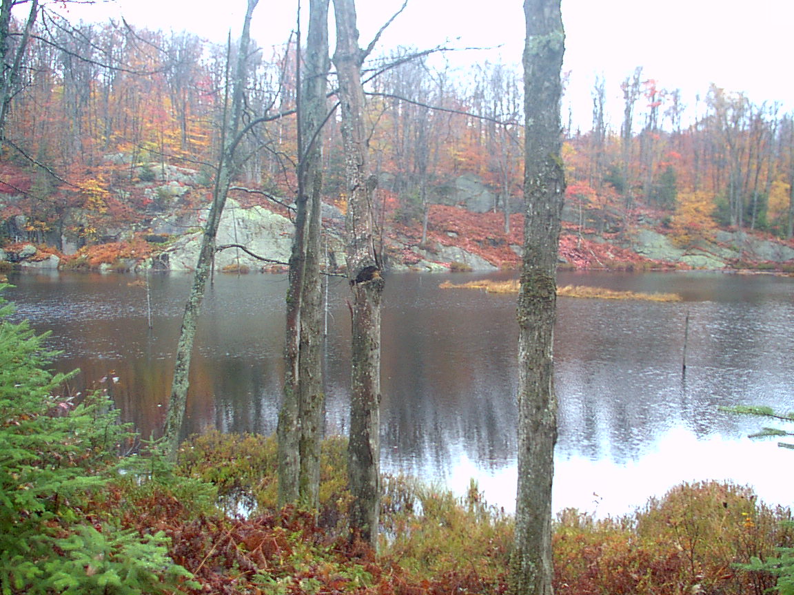
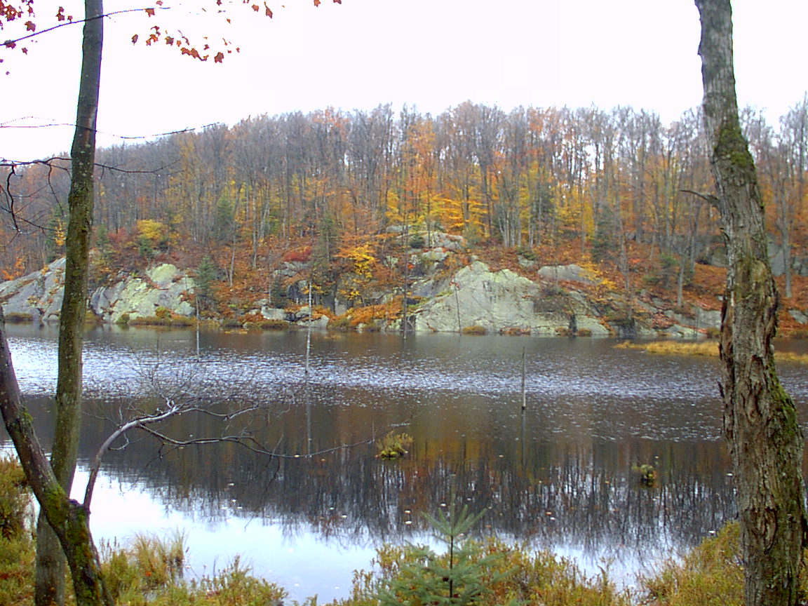
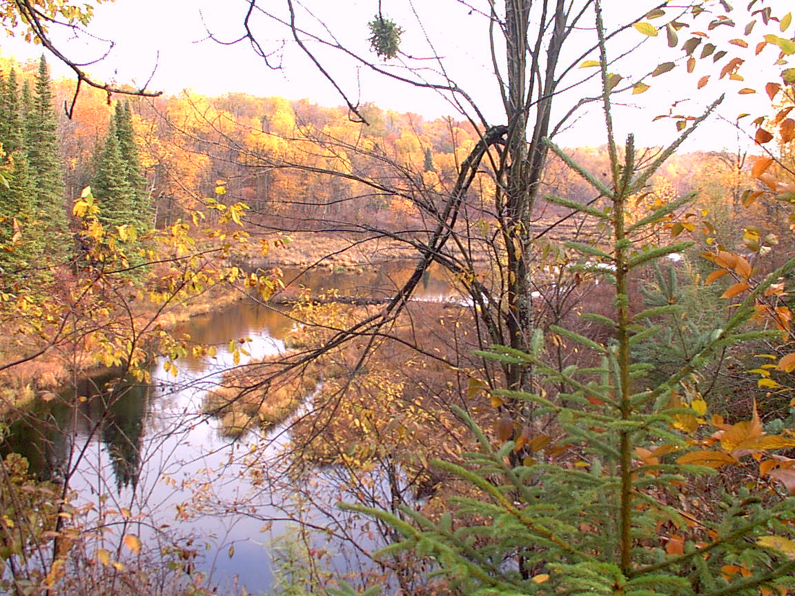
A beaver dam and pond between Middle Settlement Lake and Lost Pond.
I hiked along the trail, which I found well marked, a little rough in places, a little damp in places, but easy to follow, quite peaceful, and beautiful. About a half mile I found the intersection with the Lost Lake trail (trail 70) (5-73X70). After another part of a mile I found the marker (L-H CTY LN) at the county line referenced in the guide book.
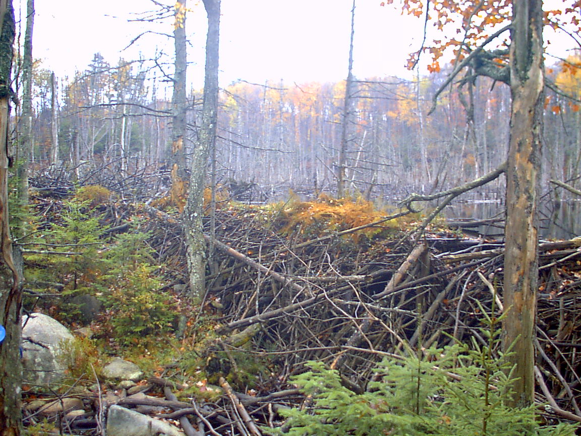
More pictures from the beaver pond.
As I hiked along here, I began to feel better and better. I decided that it was not unreasonable to hike all the way out today. It would be 15-17 miles, depending on my route, but that wasn't too much. I had hiked 14 miles here in one day earlier this year. I started trying to decided whether to take trail 71 or 69 out. 71 had the advantage of no spots being under water, but was a little longer. Trail 69 was shorter, and probably less elevation change, but there was that annoying spot that was under 2 feet of water. I decided to defer my decision, but that I was definitely feeling good enough to hike out today, get home for some pizza for supper, and then run with the boys in the morning. I was definitely into it!
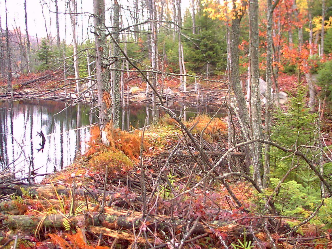
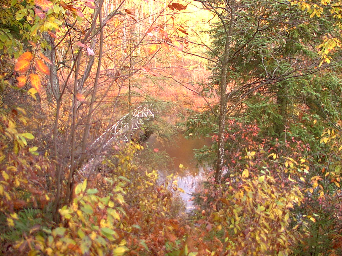
These are from the end of Lost Lake, looking SW. Lost Lake was beautiful, and the scene was set off by the stone cliffs rising out of the water directly across. The rain during the night had made everything wet. The leaves that were remaining above the ground were all located between the tops of my gaiters and the top of my shoulders, so by the time I got here I was pretty well soaked to the skin. Since my pants and socks were wet, the water just complied with gravity and ended up in my boots, which although very waterproof, were now wet from the outside and from the inside.
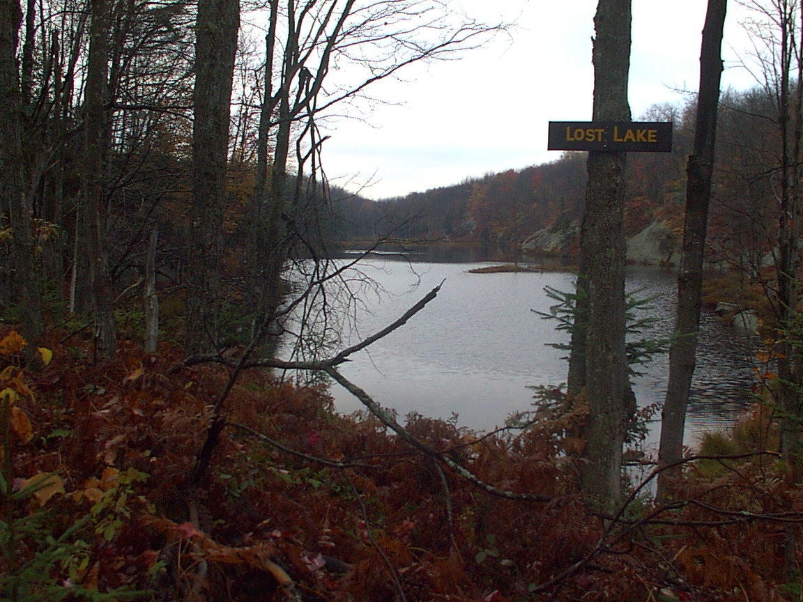
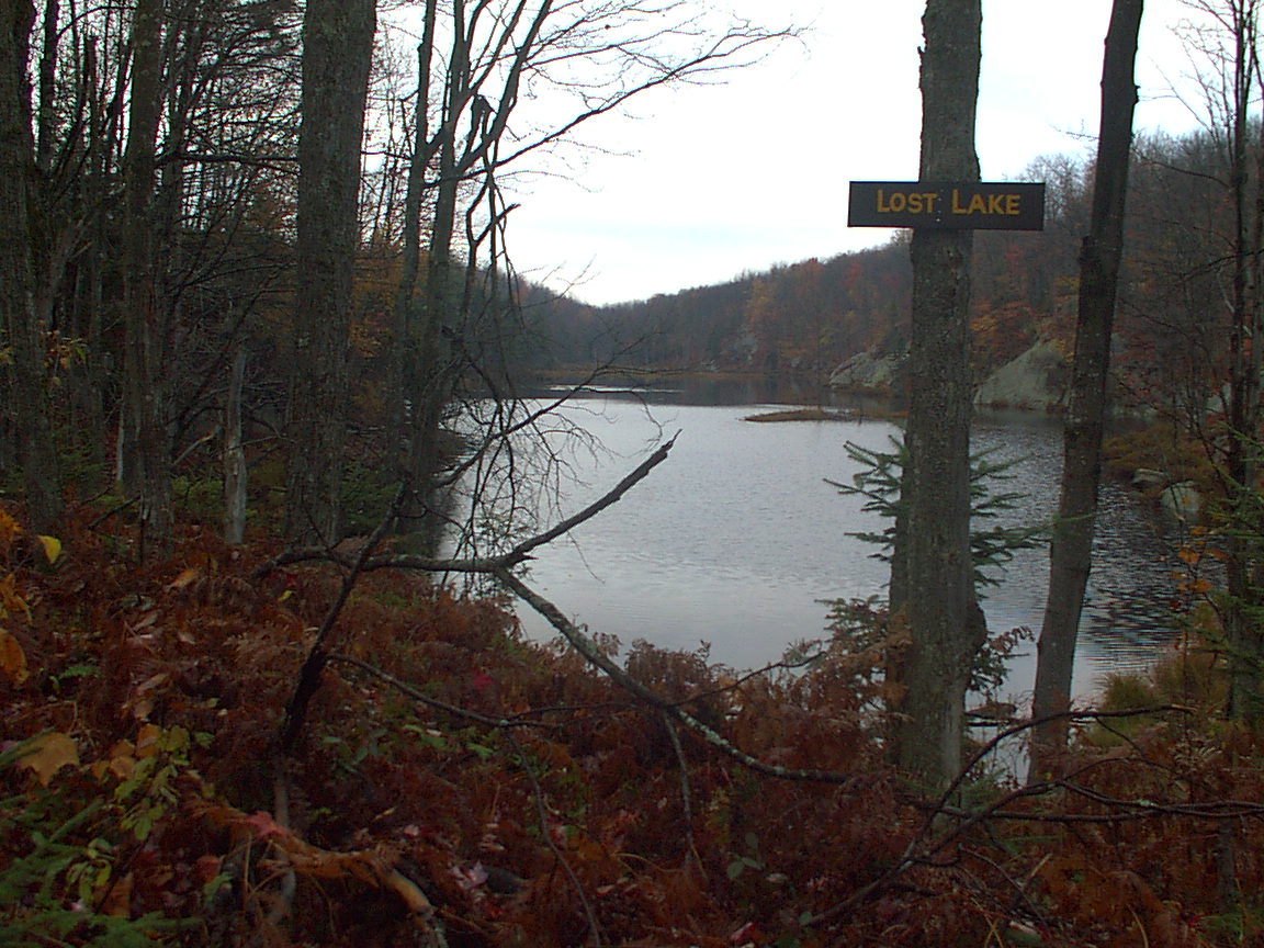
The DEC placed a sign from the best vista on the lake shore, which captions the photos.
Hiking along here was very pleasant. There were some open areas, low spots, and then approaching the Middle Branch River. There was a long bridge over the river. Beyond that, a very steep descent to another even longer bridge over the outlet flow of East Pine Pond.
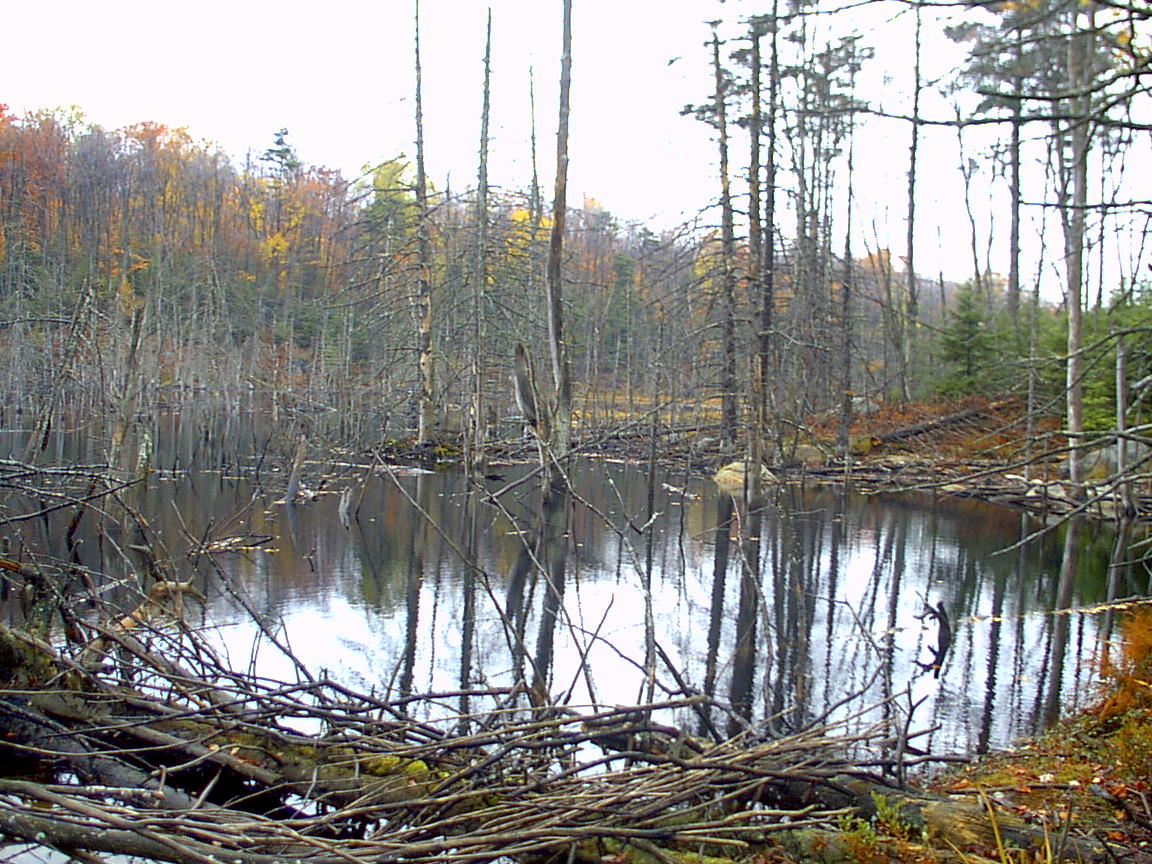
Here are some shots of East Pine Pond, and looking down from above the bridge over its outlet (BR EPP OUT).
Hiking past this bridge, the trail looked almost like a road, with two distinct tracks, and maybe even the tracks of a four-wheel ATV. This brought me to the spot of the Pine Lake lean-to (4.1 miles so far today), where I decided to change socks (remember those wet boots?), have a snack, and continue on. However, upon arriving where I thought (according to the guide book and map) the lean-to should be, I found a sign posted that said the lean-to had fallen in, and been removed by DEC. The sign said that if the lean-to should be replaced, the DEC would post a sign here to let people know. Seems to me like anyone needing a lean-to here ought to know about whether it exists or not before getting here. Also seems to me like anyone arriving here will know if the lean-to exists without benefit of a sign being posted to say so. I could be wrong.
So, without a lean-to to sit in, I decided to push on to the the bridge over the outlet of Big Otter Lake, about 1.6 miles.
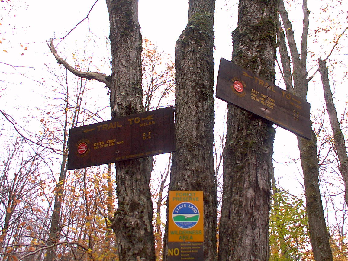
This is the intersection (5-67X69) where the Big Otter Lake East trail begins. A half mile past this sign is the bridge over the outlet of Big Otter, the beginning of Otter Creek, and a place to sit down. Which I did, and changed my socks, and filtered two bottles of water. I had made the mistake of not filtering water the day I hiked around the 71-69 loop, so today I decided to err on the side of too much water, even though I had those tow bottles waiting for me 1.5 miles this side of the parking lot. The water from Big Otter tasted good, but was quite brown - probably tannin.
Just below the bridge, two guys in kayaks were paddling around. They said they had spent the night on the lake and were heading back down the creek.
I got going, and paused at the intersection (5-71X69) with the Lost Creek trail. This is where I had to decide which way to go. The posted signs said the dry route (71) was a mile longer than the wet route (69), and I opted for shorter. I figured I had another dry pair of socks. A half mile past this, I entered the water. I tried to stay on the beaver dam at the left edge but that only worked for a few yards, and then I had to either try to bushwhack around it, like I did when I backpacked here before, or go right into the water, like we did when Bob and I ran this way. I decided to plunge in. Pretty soon my boots were full of water. So I just kept going.
Within a half mile of the water, I could still feel water swashing around in my boots, and decided to try to dry things out a little before my feet got too torn up. I found a log in a sunny spot and took off my gaiters, socks and poured the water out of my boots. I used my wet socks to try to sop some of the water out of the boots. Then put on my last pair of dry socks, put the boots on, and got going. My feet were wet, but not squishing.
Now I just hiked along, keeping up my pace, hoping to get to the trailhead by 3:30. As I approached the blue tent from the west this time I didn't know what to expect. I had heard about 15 gun shots earlier in the day, while hiking on the Lost Lake trail, and I figured if that was a hunting camp, there might be hunters afoot. But there was no one visible, and no one shot at me. Down the trail past the tent, beyond the crest of the shoulder of Moose River Mountain, I saw a couple guys heading up the slope toward me. One was pulling a large, high-wheeled cart. The other was carrying a beer can. I stopped and talked with them for a while. They are brothers, one from Mexico, the other from Pulaski, who get a permit for their hunting camp, and have been coming in here for 40 years. They had been down the trail removing a blowdown from the trail, with their tools and lunch on the cart. We swapped stories for a while, and then I headed on. It was mostly downhill from here, except for where it was uphill.
I picked up my bottles at the junction, and signed out at the register. I was back to the parking lot by 3, with 13.5 miles for the day, in a little less than 6 hours of hiking time. I met a camouflaged hunter who inquired as to the whereabouts of the state land between the register and the lot. He was going in for a little pre-dusk black powder hunting.
Based on my trips to this area, and the fact that the only two lean-tos in the area are within 3 miles of NY28 and susceptible to pretenders getting in there for the weekend nights, I will probably not return to this area, unless it is to ski the 69 trail, or to run the 71-69 loop again. It's a nice peaceful area, just too many hunters and weekend novices for my interests.