


|
|
|
Well, if you read those plans, you'll see that things changed. They changed some more, and here is what I actually did on May 3. Well, I didn't get up until 2:45, 45 minutes late already. Cooked breakfast and hit the road about 3:15. I got to the trailhead about 6:00, looked up the elevation on the map, and set my GPS and watch to 1460'. I recorded other data in my logbook and noted that it was windy, cold and clear. I decided to strap my fleece warmth layer to the outside of my pack just in case. I had decided (per plan 3) to hike the whole loop if I could in trail running shoes. I knew it would be wet, but I decided that wet trail running shoes weigh less than wet hiking boots, so there are you. I put on my regular hiking gaiters.
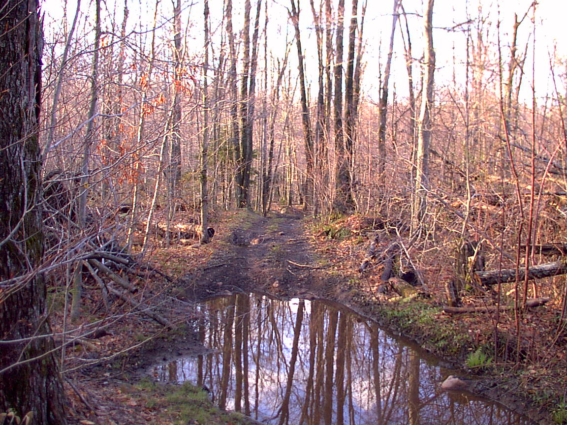
The first half mile is what I'd call hiking trail - up and down through the woods, marked. Here at 0.6 miles you turn left and start following what the book calls a jeep trail. It looks like an old logging trail to me, based on how we used to really tear the trail up skidding logs out with our hoopie tractors. Very deep ruts filled with very cold muddy water. When I saw the ice on top of the puddles I knew I was not imagining that it was cold.
From this point the trail became much more difficult. Trying to keep feet dry (futilely) I hiked around the deep, cold puddles, sliding on the banks, wondering if I am becoming a "high-banker." I slid into the water several times and my feet were no longer dry. I also began to realize how easy it would be to twist an ankle, knee, back or other part, possibly fall, possibly break something, possibly ruin 5 months of diligent and difficult training for the Comrades in 6 weeks. These little nagging thoughts in the back of my mind kept at me all day. At 2.1 miles, little less than an hour from the car, I reached Little Otter Pond, but didn't see any little otters. Didn't see any beavers either, but there was one lodge on the shore near the trail. Very wet along here, and it looked like someone had cleared some trails coming in from the left, possibly from private land, but I don't know. Hmmm, are those clouds in the sky that was noted in the parking lot as being clear? Couldn't be, because the forecast I saw was for sunny, windy and 50s.
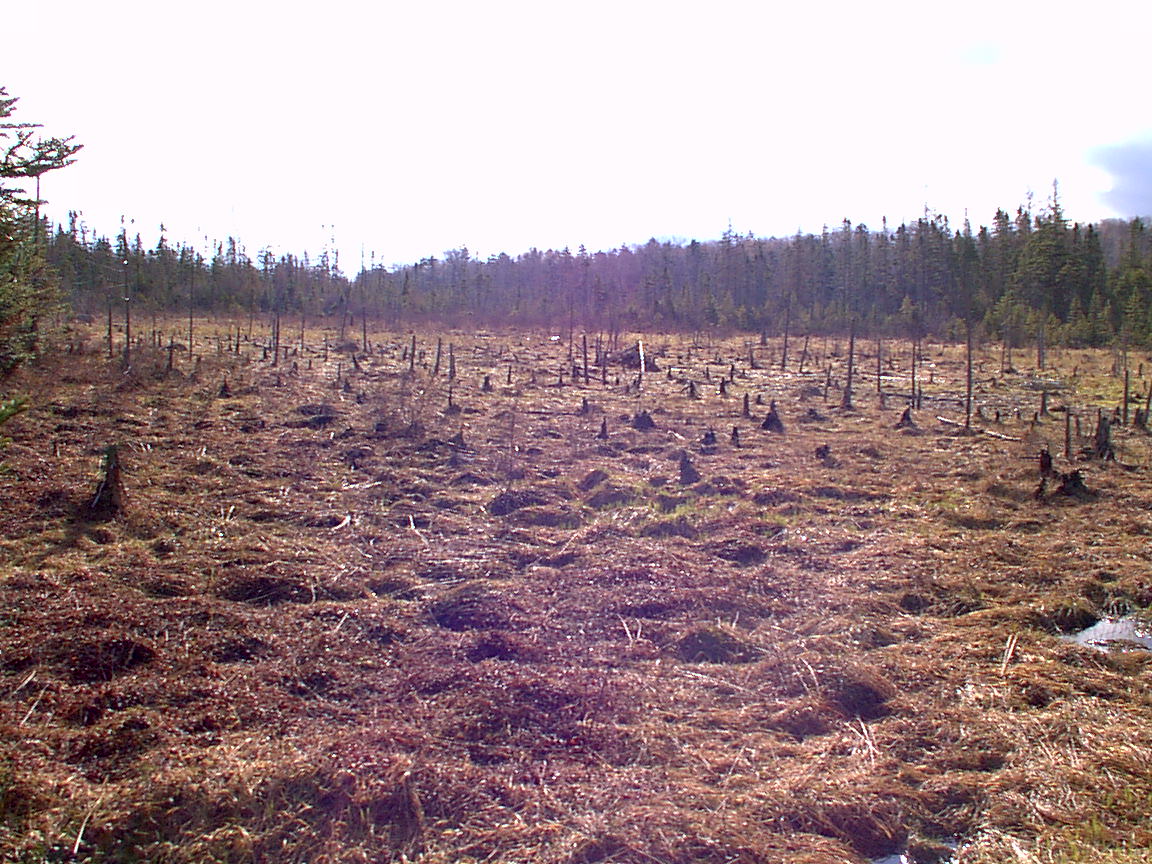
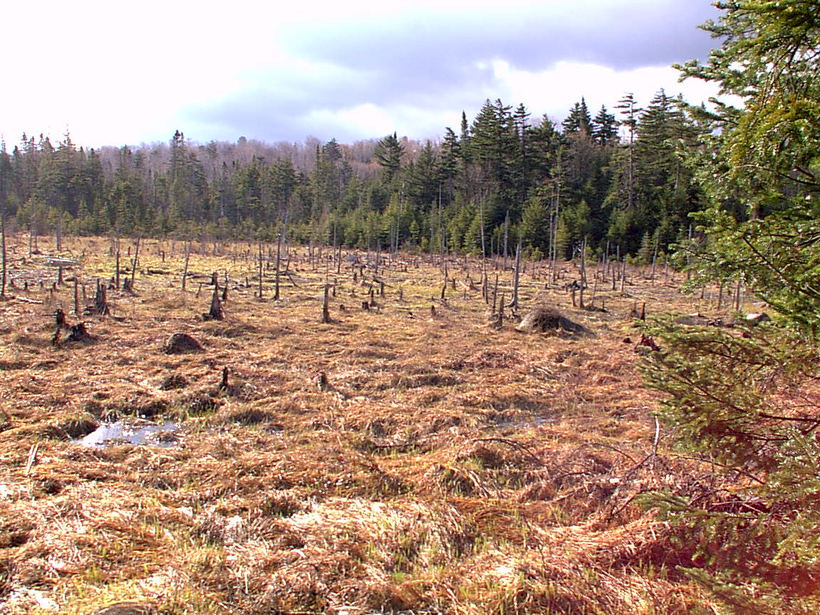
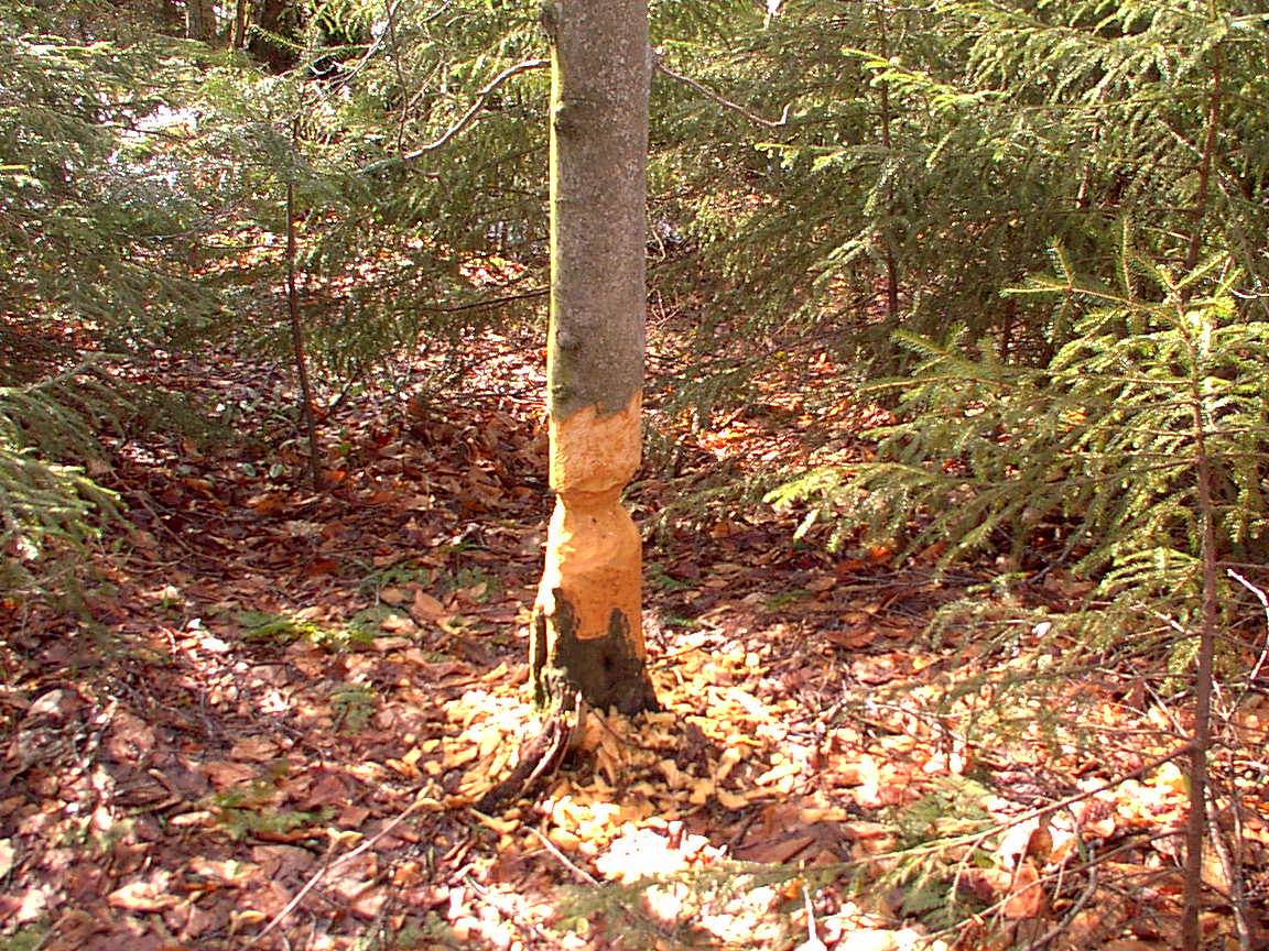
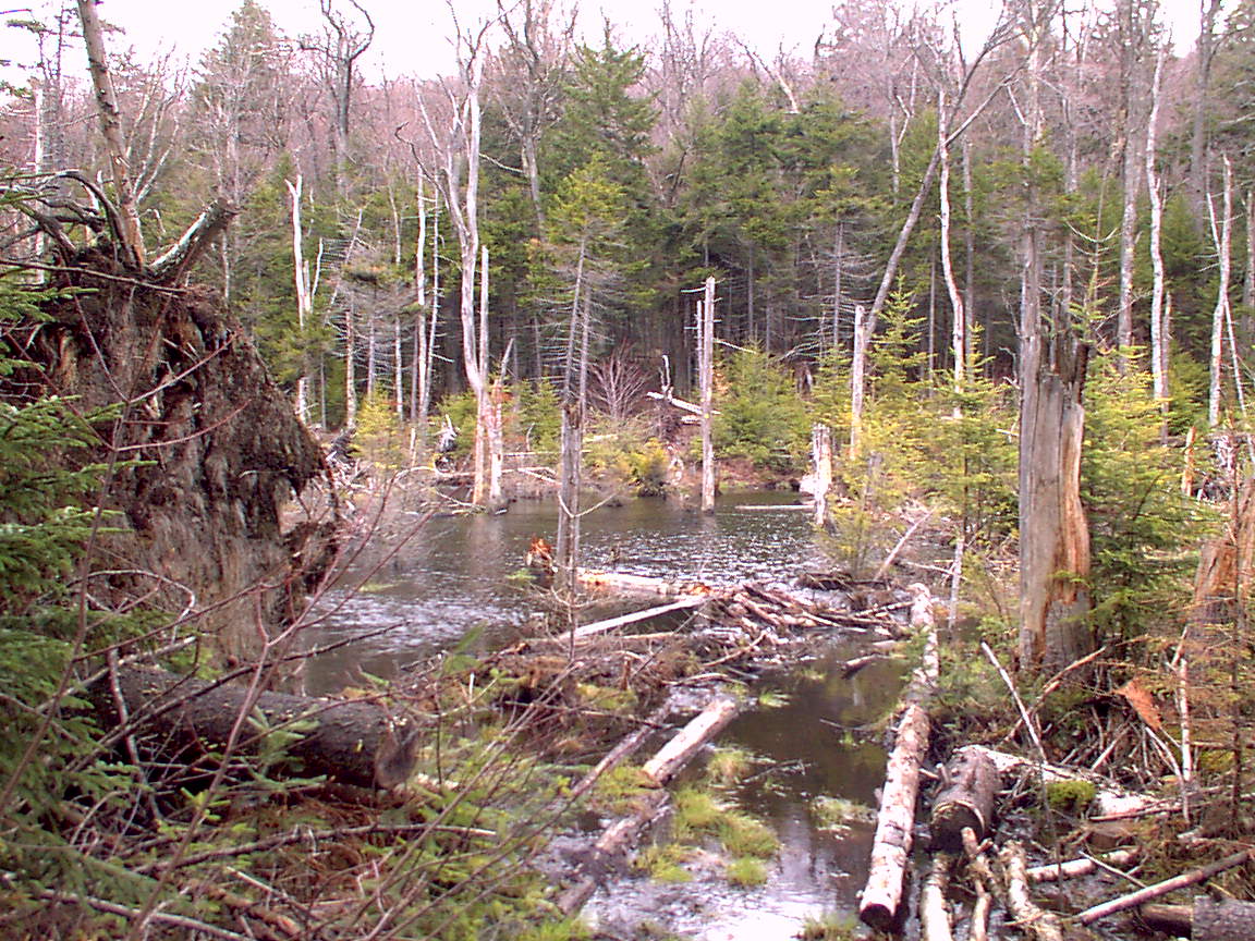
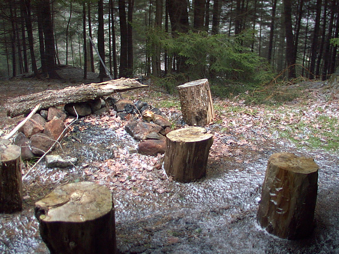
A little farther on as the books says the outlet of Little Otter is crossed twice, and you pass an old beaver bog which is now drained, shown below.
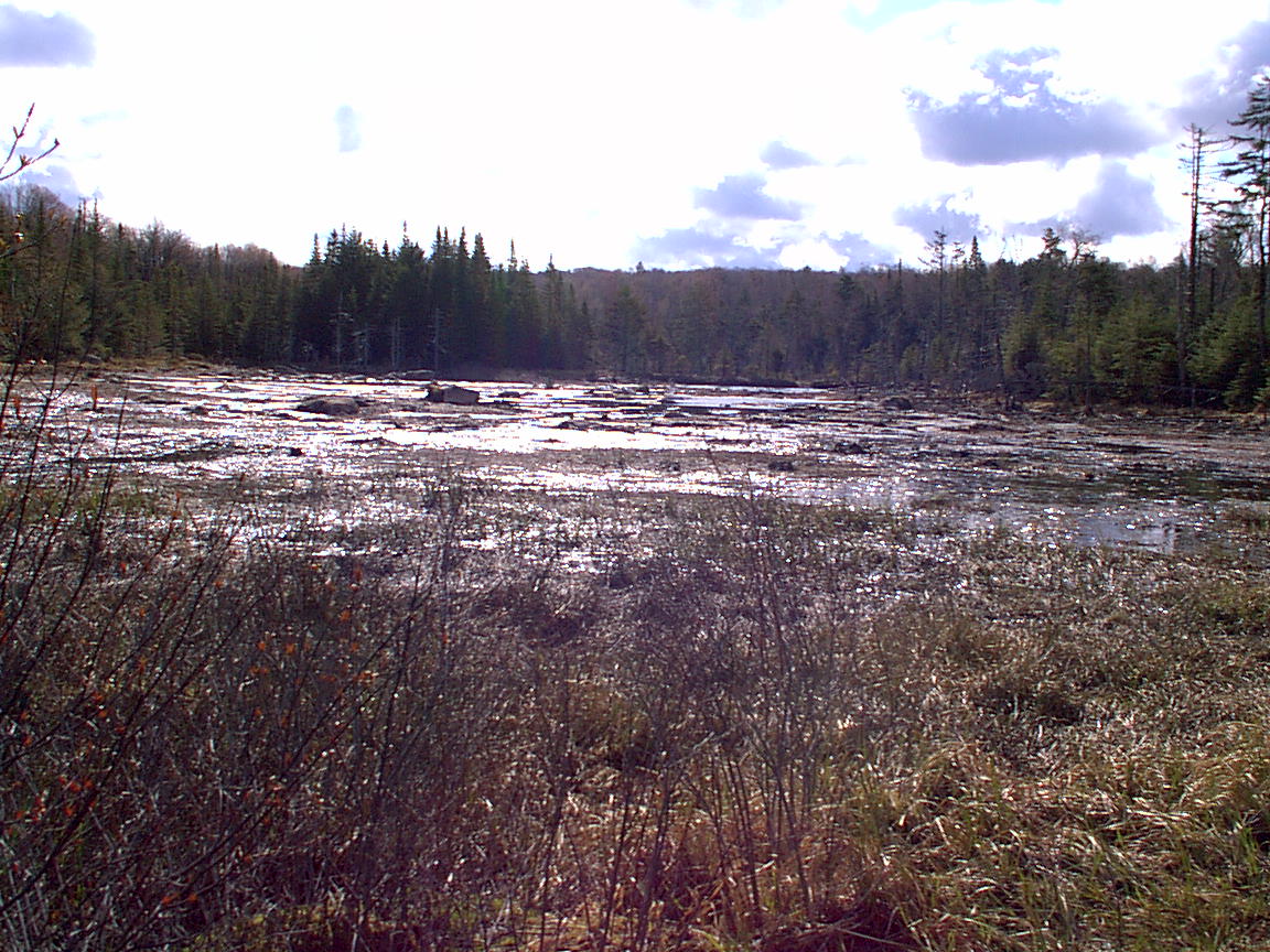
At nearly 5 miles the trail submerges. This is where beaver activity, pictured below, has created a new pond, which happens to lie across the trail. The beaver seem to use the edge of the trail and the little banks formed by the vehicles digging out ruts, to build a dam along the edge of the road. Then, depending on the drainage, a pond is formed either on or off the trail. Here, the pond covers the trail, and the book suggests a bushwhack to the right. I thought that looked like a good idea, and as my track map shows, I went around this part of the trail in the woods.
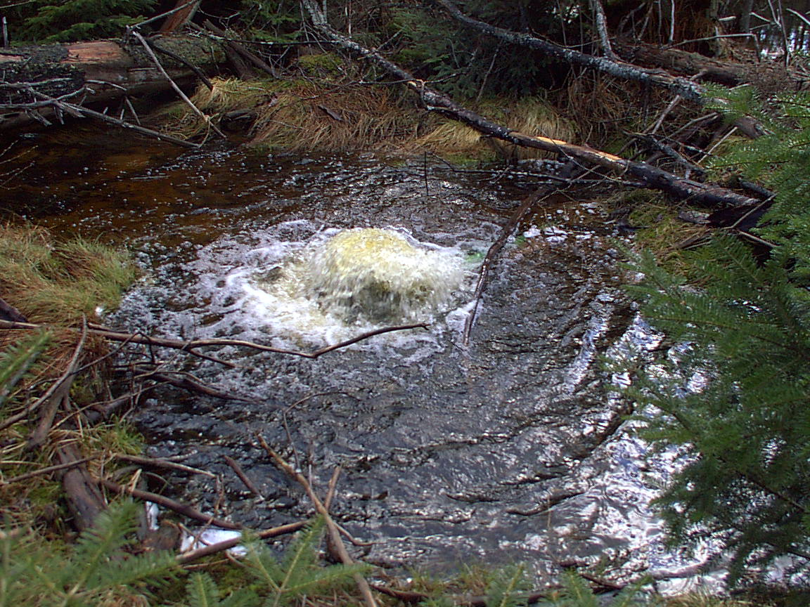
Back on the trail, you cross yet another beaver-dammed area. There is an old bridge made of steel tracks, and this geyser. It is pretty loud, but I realize it comes from a plastic pipe about 8" diameter than someone placed to drain an upper area. It then goes under a little dam and then an elbow in the pipe lets the water out here. Someone took a lot of trouble to help the drainage, but my feet were under water on the edge of the trail where I took this photo. Those beavers dam. Those damn beavers.
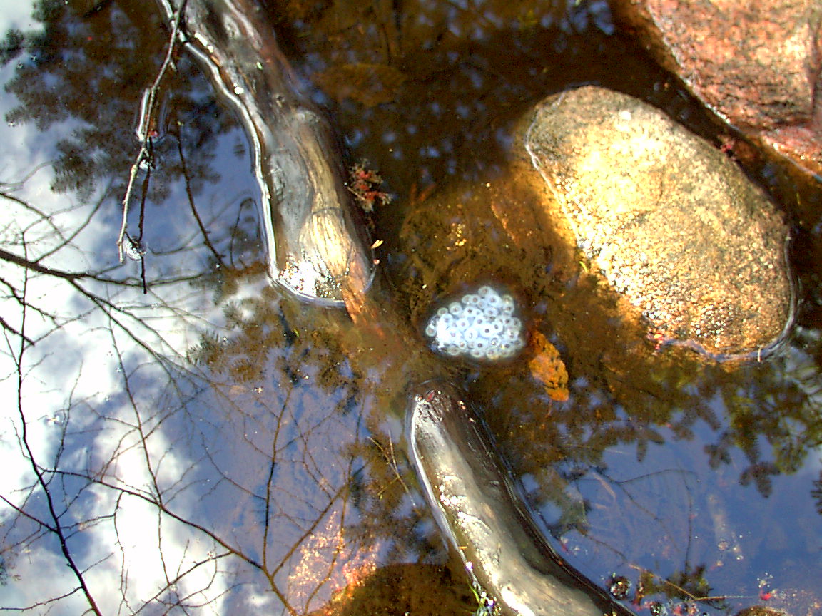
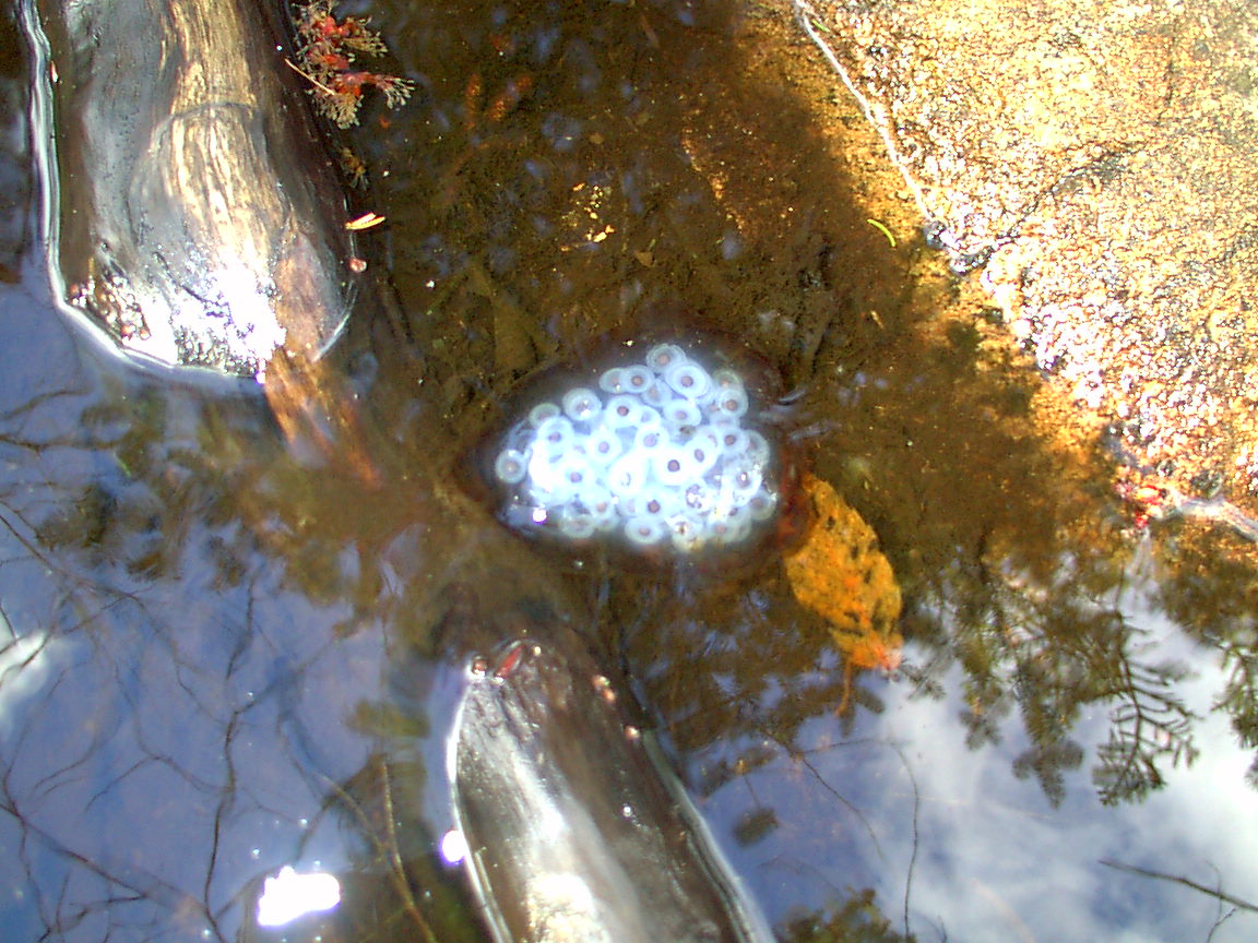
A little farther on some frog eggs, tadpole eggs? in a stream crossing the trail.
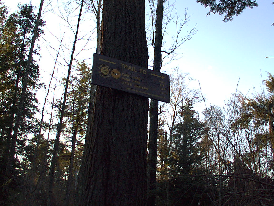
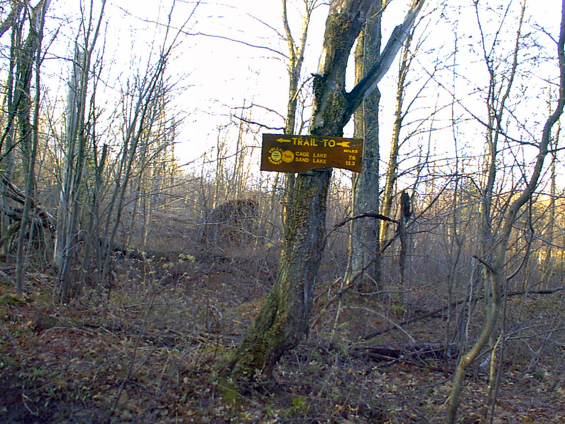
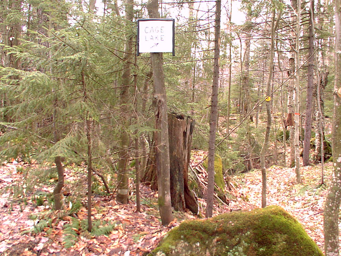
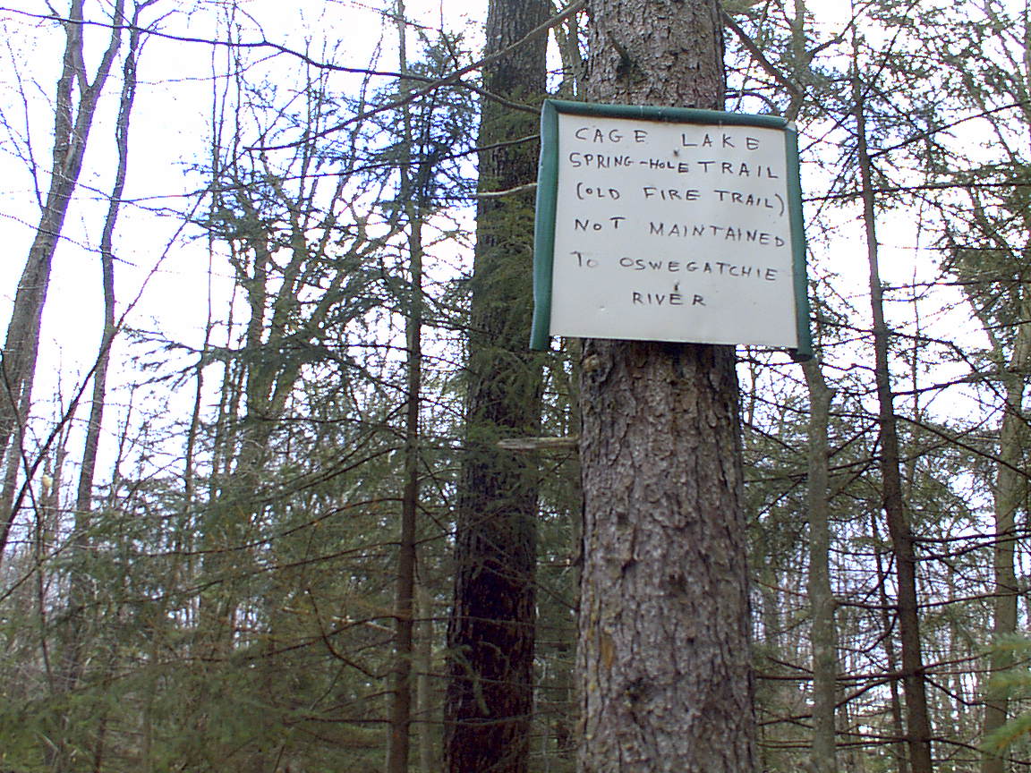
Up until this point, since joining the jeep trail, which is an old railroad bed, there were no markers. Not that markers are needed - you can just follow the ruts. Here, near the edge of Buck Pond, a sign that I am on the right track. On the way out I tried to go look at Buck Pond, but there is a private property notice about 100 yards before you can get the the shore. There is a large house, and outbuildings there, with a flag flying both the American and the MIA/POW flags. I respected the private property sign and went no closer. In any case, the trail to Cage Lake bends right here as the sign says, and the trial is marked with yellow markers again. For a little way. Another sign posted marks the junction of the old Springhole trail, which goes about due East to the Oswegatchie River. As the sign (and the guide book) says, the trail is no longer maintained.
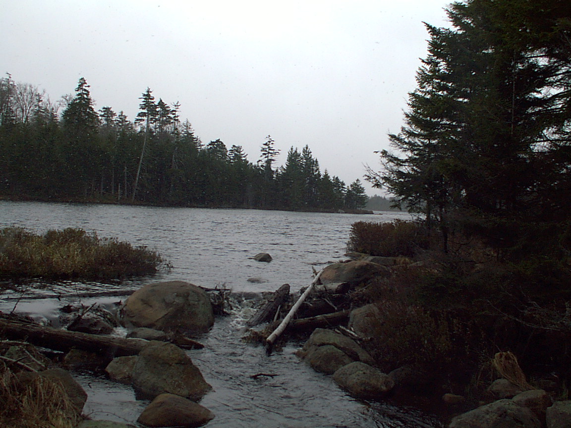
Continuing on, as the guide book says, the trail enters an extended swamp area. That part is a little boggy and most, requiring several crossings on downed, slippery logs. It all culminates with the need to cross a beaver dam itself, holding back a branch of the Hammer Creek, pictured below. It looks impossibly impassable when you are actually there. This web page is a testimonial to the fact that I did not drown.
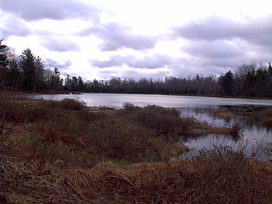
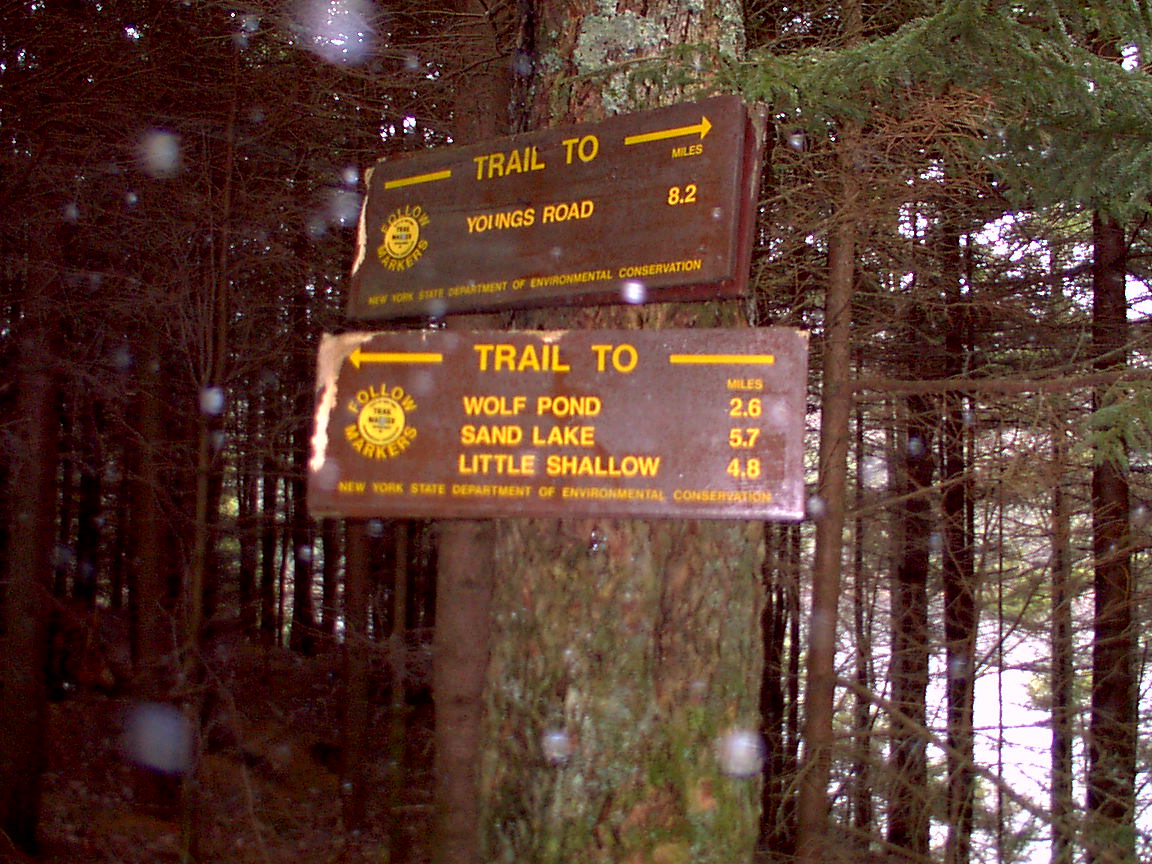
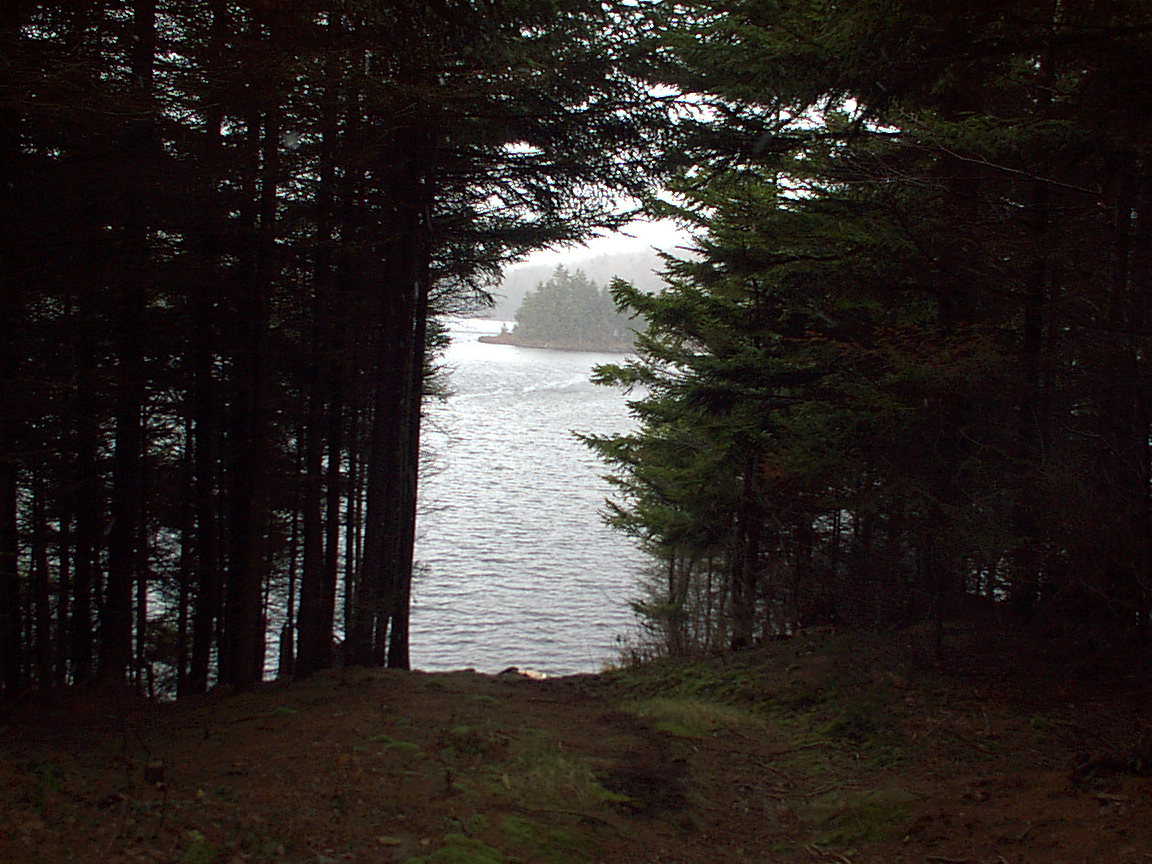
Finally reaching my first stopping point, I rock-hop across the Cage Lake outlet. The lake is seen here from a rock in the middle of its outlet looking to the right. Up the bank, the intersection with the trail that continues on to Wolf Pond, Sand Lake, Little Shallow, and the route planned originally (1st plan.)
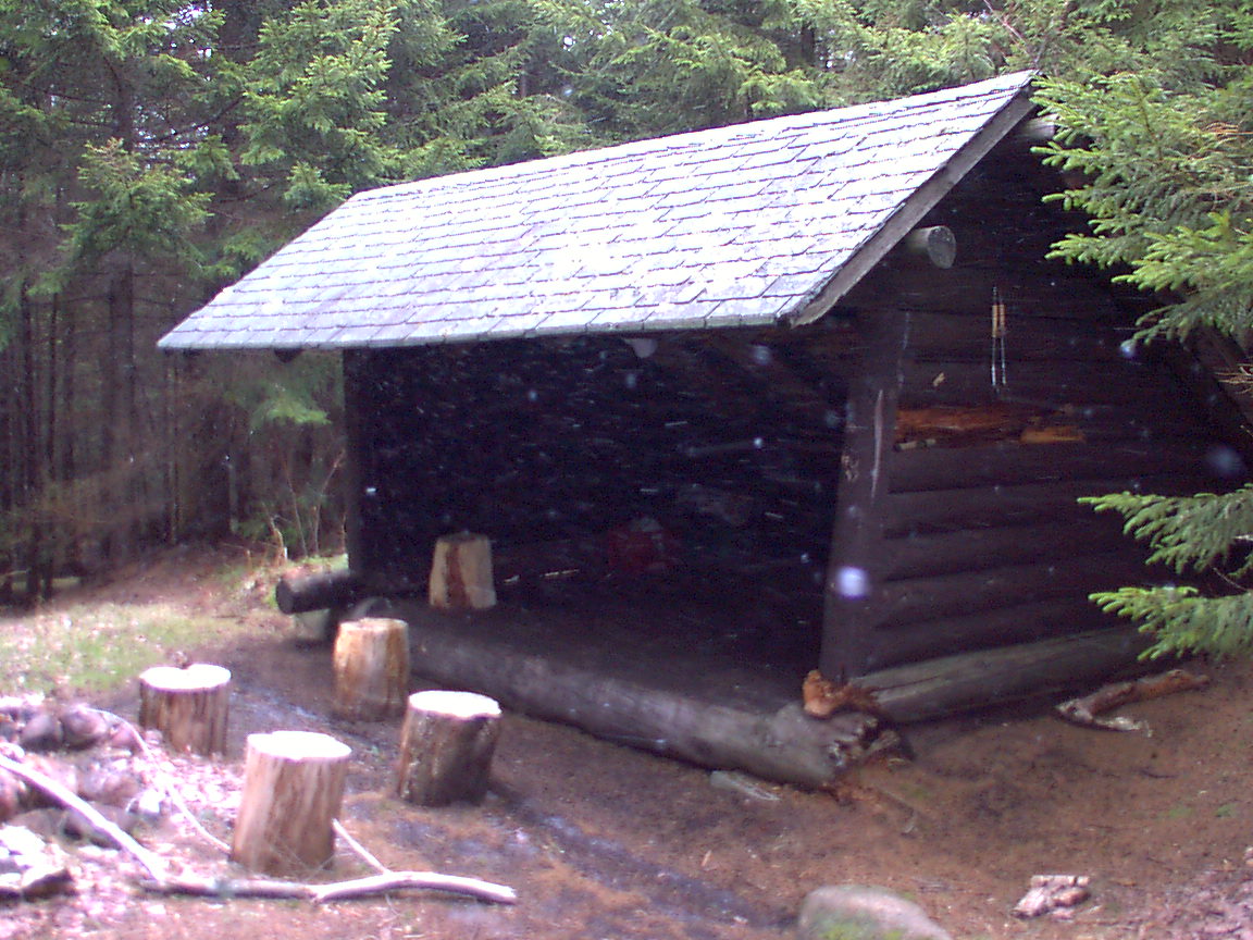
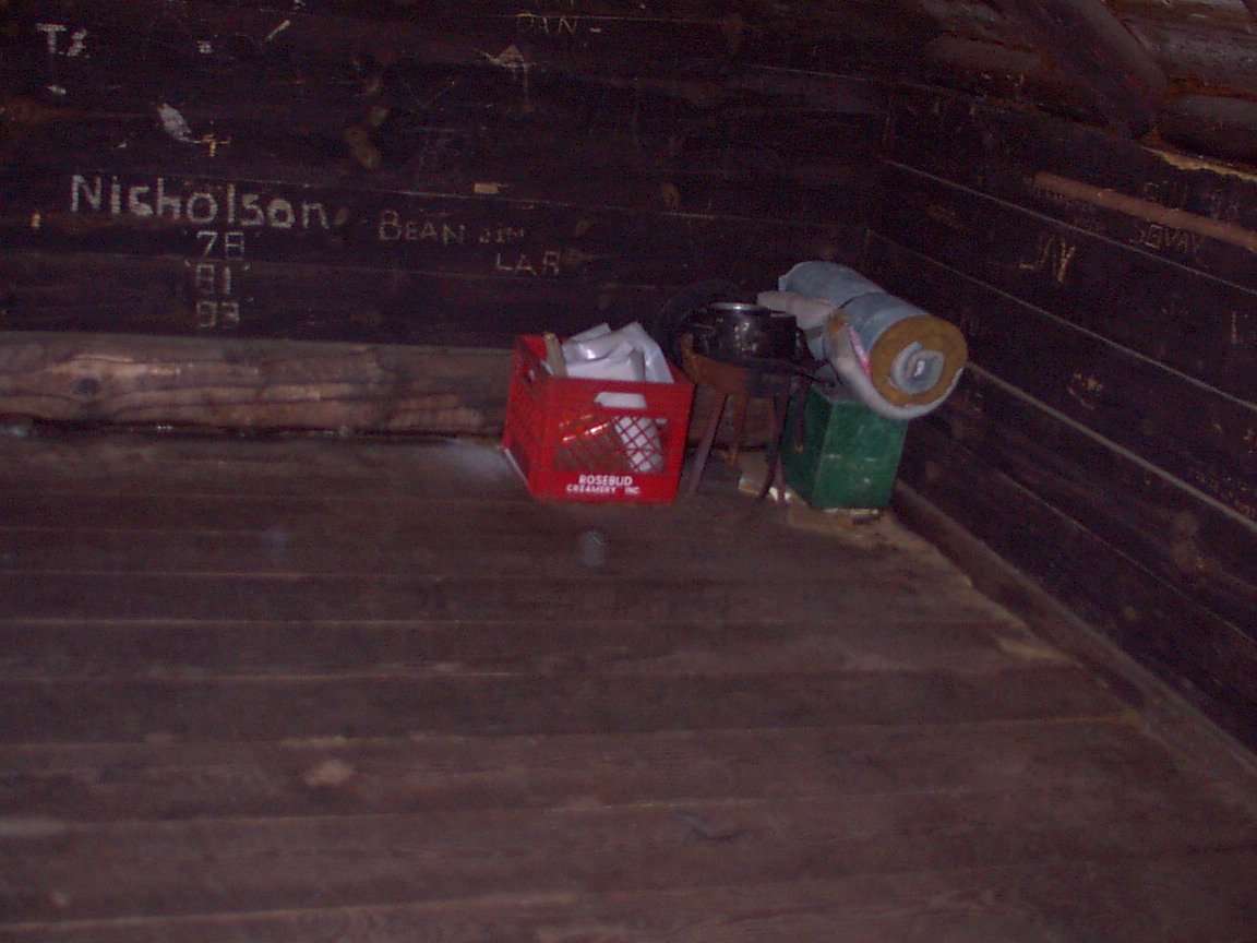
At the lean-to, it was very windy and began to snow sideways. How interesting. I slid my pack off, and began looking around. A very nice lean-to, well-maintained, with lots of nice gear and features. Several stump seats, hot-god tongs, a fishing pole, several blankets, plastic, broom, very tidy. In back there was a very clean privy. I lifted the toilet seat cover and found a big black spider waiting on the seat. There was also a very crazy jackrabbit here. It ran right at me, coming within a couple of feet then sprinting away. It did this a couple of times. This was the only wildlife I saw, except for a couple of pheasants I surprised on the way here and a few small birds. I took off my shoes and socks to dry them a little and hung my socks on a nail in the breeze. I put a blanket on a stump and got out my food and had lunch on hard boiled eggs, prosciutto, cheese and pecans. As I sat there my feet got pretty cold so I dug out a pair of dry socks on put my feet into some empty plastic grocery sacks brought along for packing out garbage. As I sat there it got windier and snowier and colder.
I sat in the lean-to thinking things over. I figured to reach the Oswegatchie via my planned bushwhack would take about two hours. It was now noon. Earlier I had thought I'd be here by 10 and complete the bushwhack by noon. I decided I didn't have the right gear to spend the night here and hike back out tomorrow. It was going to be much colder than I thought. My GPS said I had cover 8.1 miles in 3:29 moving time and over an hour stopped time (dilly-dallying, taking pictures, eating, etc.). So I thought it would be a push to complete the route as planned, and not being prepared to spend a veyr cold night, reluctantly decided I should hike back out the way I came. Reluctant (and partly because) that trail had been very hard. It took longer than I planned, was much wetter, and I was constantly sliding around, twisting all parts of me, which made me tired and sore. But it was the smart thing to do. I grabbed my socks to put them away and they were frozen stiff. I had donned my fleece when i stopped and decided to leave it on while I hiked out - and I never felt warm. I packed everything up and put my wet shoes back on, tidied up the lean-to and headed back into the wind and snow.
After reaching Buck Pond and trying to investigate, I found another intersection and what looked like a hunting camp - an outhouse, several poles nailed across tree to hang game, a garbage heap, and a couple stacks of cut firewood. A little farther down the trail, here come three guys riding two ATVs. They said they were going in to Buck Pond - I imagine to the house I saw. One guy said he was the adopter of the Cage Lake lean-to and asked about its condition. They were friendly. Going back I did not bushwhack around the beaver swamp covering the trail but tried to hug the bank which was a beaver dam. This didn't work too well and I got really wet feet, but I figured that was inevitable. I had removed the gaiters coming in, since the full gaiters do not stay down on running shoes, but just did in at your ankle where the shoe is cut low in the back. Wet feet, too bad. I just slogged on through and tried not to fall. I had fallen once on the way in and cut my armpit on a sharp stick. I had fallen a second time trying to cross some wet downfalls, and nearly twisted my knee. Well, I did twist it, but I didn't hear anything snap. Also, while I was eating lunch in the lean-to I felt a twinge in my right quad, like a tear, and so I was just thinking of not tearing myself up too much. About 1.5 miles form the trailhead I met two men hiking in with large packs. At the register I found they were from Binghamton and planning to spend the night at Cage Lake before going on. I thought they'd really have to move fast to get there by dark. I got back to the trailhead about 3:30, not having stopped at all to dilly-dally on the way out. I changed my clothes and got going. As I drove by Fort Drum I called Paul to see if he was around but he wasn't home from the field yet. I was very sleepy on the way home, but got there about 7. |
|
|