|
|
|
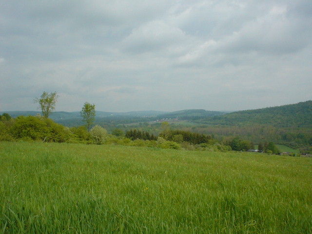
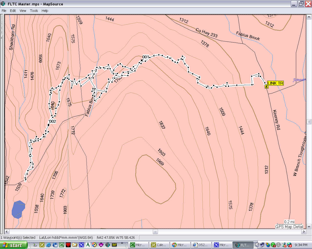
I wasn't going to hike today, but Cathy threw me out and I decided since it wasn't going to rain until later that I would try to hike wherever the Link Trail seems to go. I headed to the trail marker I had seen on Keeney Road south of Fabius and started there. The trail is good and marked well as far as it is ready to hike. It starts West from the Keeney Road crossing. I don't know where the trail goes south or east of there - I tried to follow it but I didn't see any more blazes. The blazes are blue and very clear. You go up slightly through some woods and then skirt around a couple of hayfields, then into the woods. There are a couple of bridges and lots of planking through wet areas. A view north to Fabius from the edge of a field on the trail. Fabius School in distance.
At the waypoint 001 the marked part of the trail ends. From there, I followed orange or blue paint on trees, orange or pink surveyor's tape, or got lost. I got lost quite a lot. Even with the blazes and my GPS. Once I made a complete circle and got turned around on myself, trying to follow blazes.
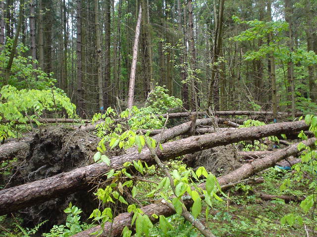
At the point marked 002 there is a fire ring, probably illegal. There were lots of beer cans (unfortunately they were already empty when I got there) discarded in the woods. You cross a few dirt roads, and I heard several vehicles chugging around with poor mufflers. I turned around on what I think is Shackham Road, but not sure. I was heading generally toward Spruce Pond, where there is a DEC camping area, and a dam. But I was getting blisters and hungry, and not sure that's where the trail went. Here is a photo of a big blowdown I hiked through on my way west. I was off-trail on the return trip and missed this. This part of the forest is marked for cutting, with lots of blue markers indicating the trees to be cut. This makes me think it will be several years before this part of the trail is open to hiking.
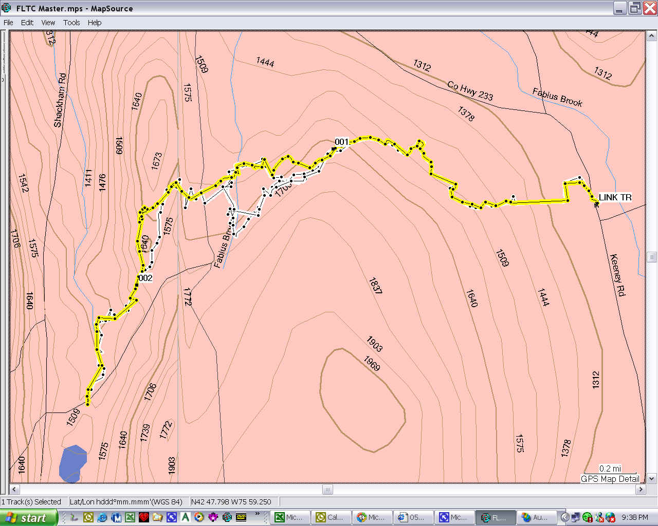
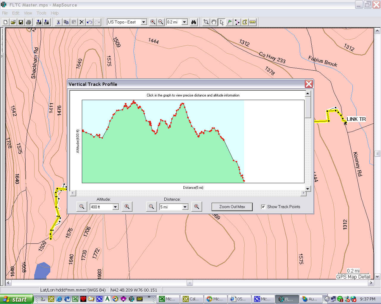
Here is the map and elevation profile of the return trip, which was mostly on the trail or where it will be. However, I was off trail for a short way after I crossed Fabius Brook and until I was back near the marked section.
|
|
|