
|
|
|
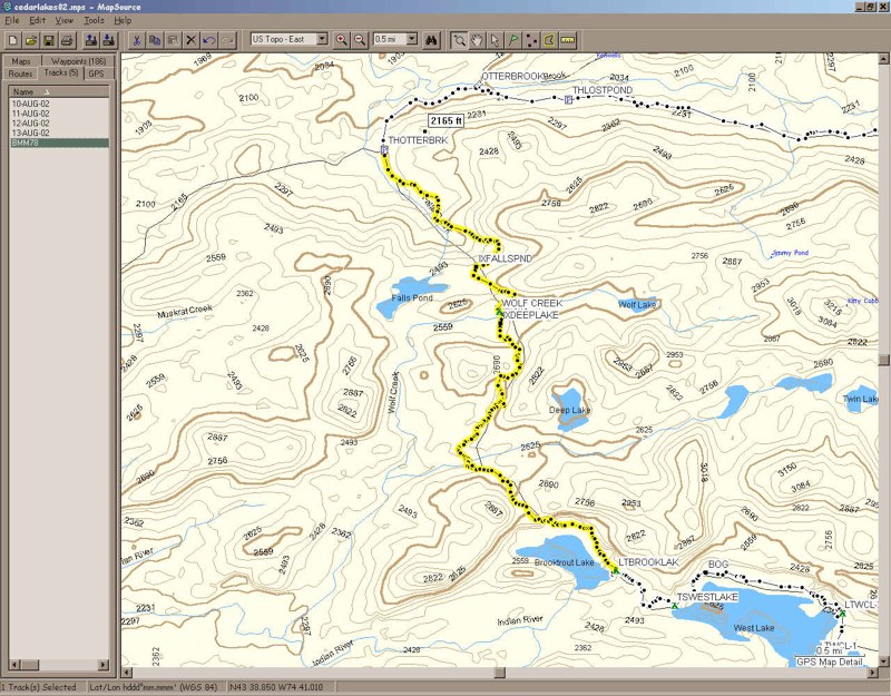
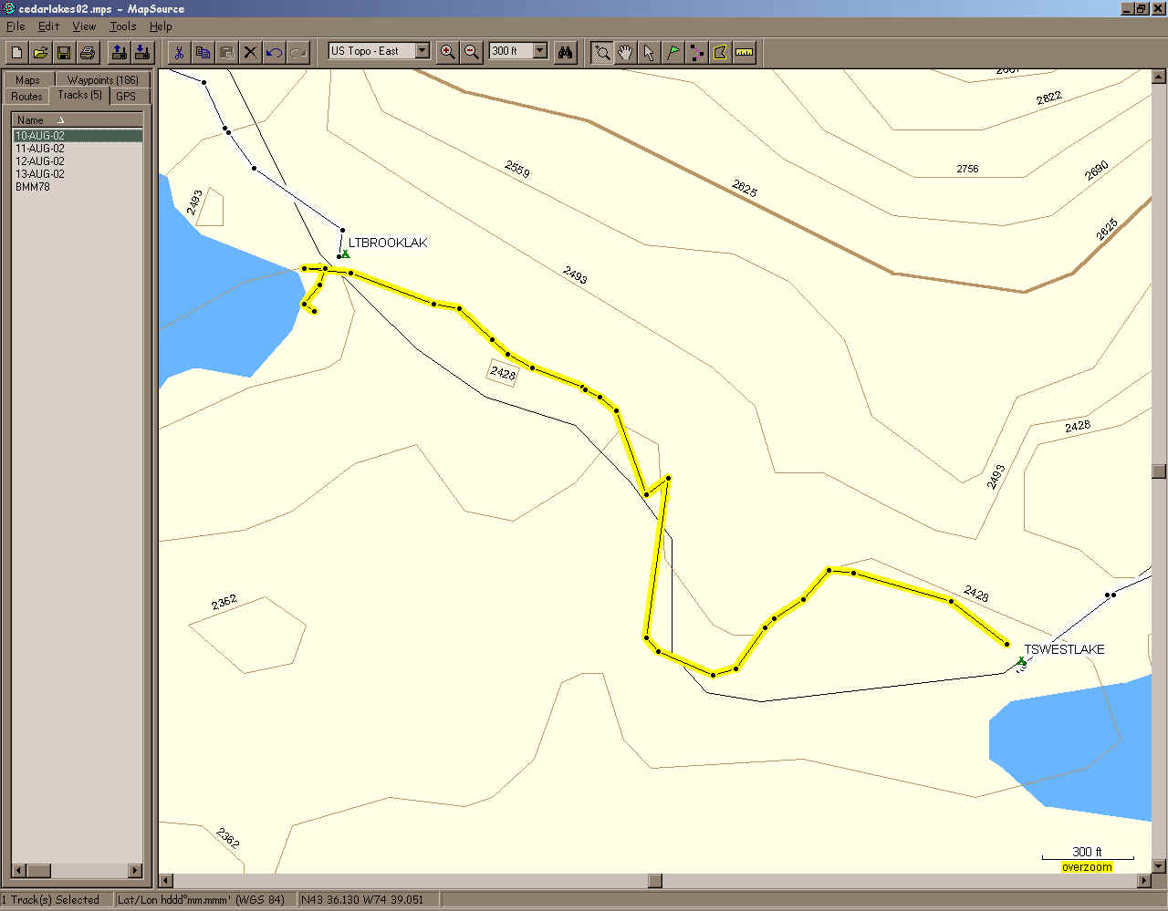
Saturday was a 7.5 mile day in two sections on the GPS. First section, trailhead to Brooktrout lake Lean-To:
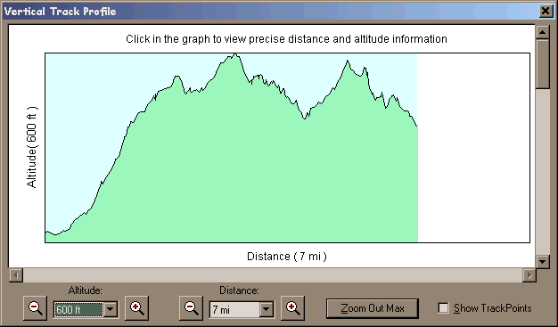 elevation profile - 600' scale elevation profile - 600' scale
Second section, Brooktrout Lake Lean-To to tent site on West Lake:
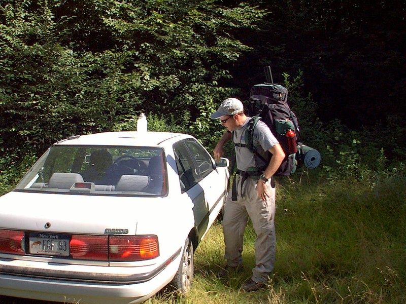
I picked Bob up at 5:30 and we drove. We stopped for a terrific breakfast at The Farm restaurant in Thendara. The food was great. Then we turned south at the Limekiln Lake park road, and signed into the Moose River Recreation Area at the entry gate. Then a very slow 11+ miles on a washed-out gravel road to the trailhead near the Otter Brook bridge. Actually, we turned right after crossing the bridge and the trailhead was nearly a mile. There were a few other cars there.
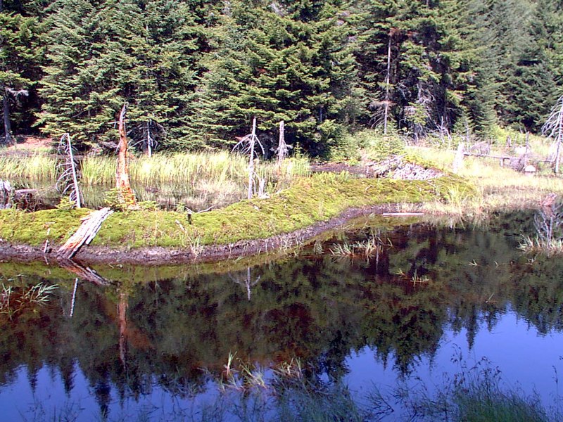
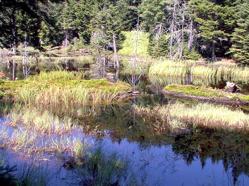
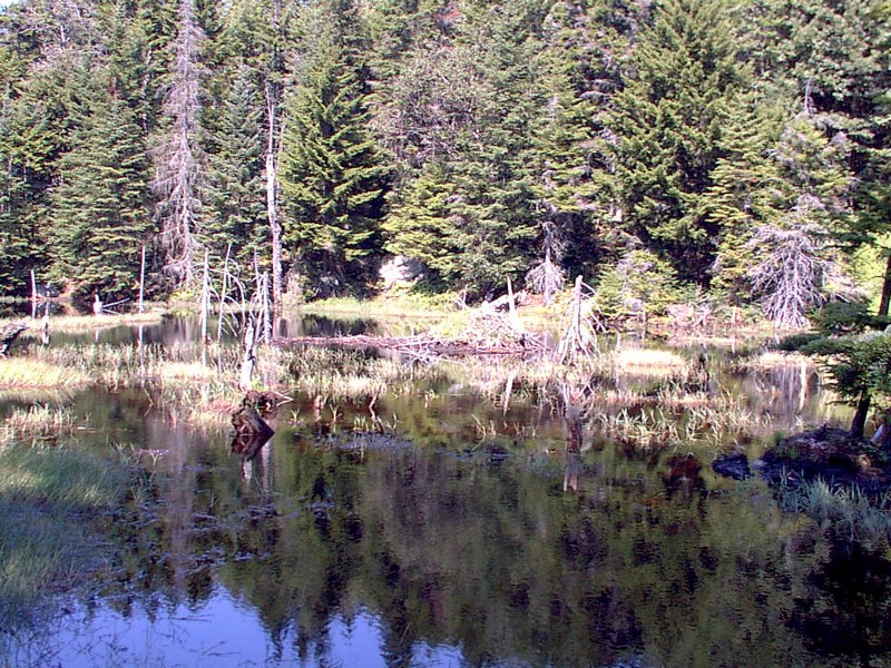
We passed a really old beaver dam that wound around the area, with grass and moss growing on top of it. And in the middle of the flooded area was the beaver lodge.
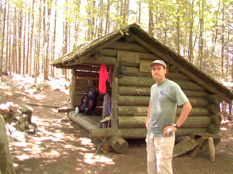
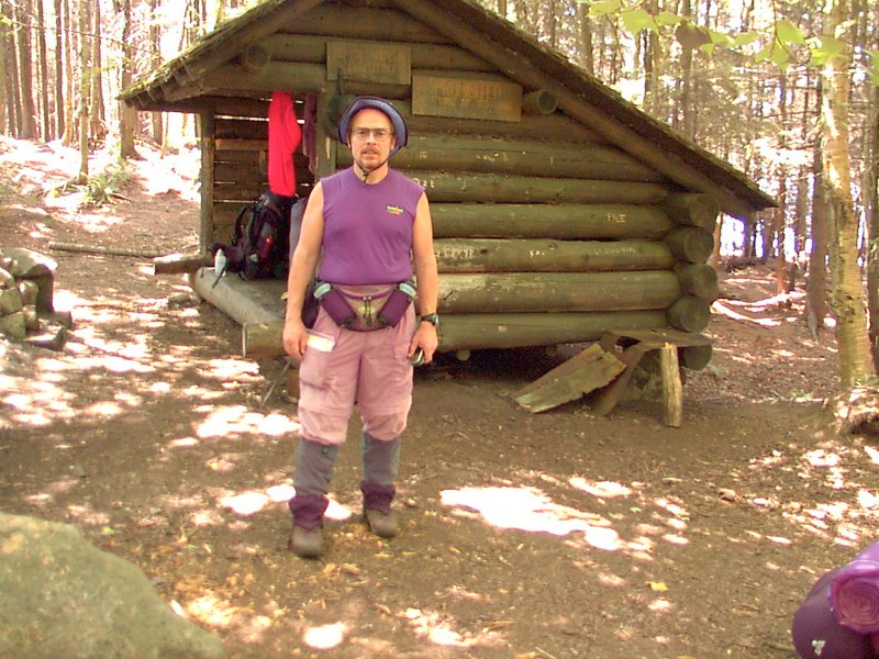
We arrived at the lean-to on Brooktrout Lake and took our packs off to look around. A couple of guys were already camped there. Bob checked out the lake shore area and I took some readings and recorded them in my trail log. And I took some photos. While we were there, two guys from Manlius caught up to us and they went to check out the lake shore also.
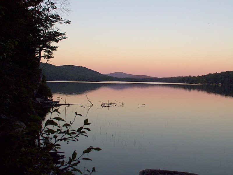
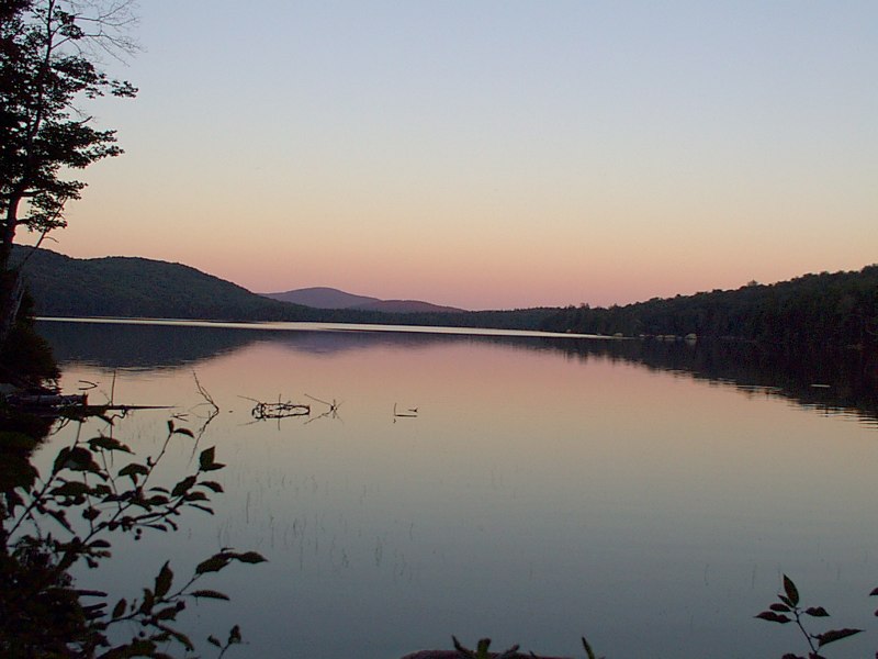
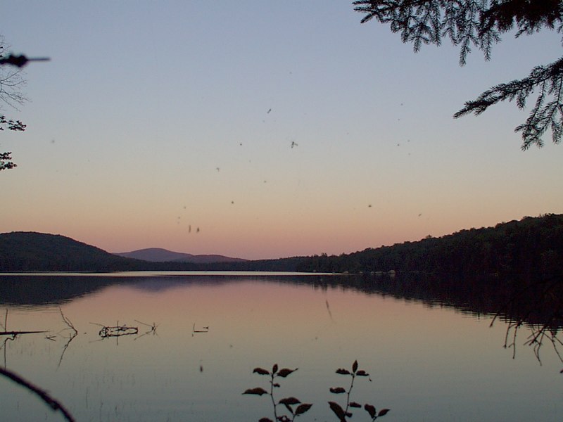
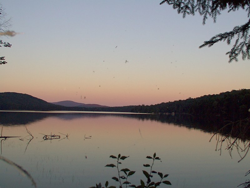
We left our packs in the lean-to and decided to check out the tenting site at the west end of West Lake. It was about 3/4 mile and off we went. We met the two fellows from the lean-to bringing back some firewood on the way over. The tent site looked pretty good and was unoccupied so we returned to the lean-to and grabbed our packs. I noticed on the way to the tent site that the GPS couldn't receive any satellites, but on the way back to the lean-to it was picking up 5 of them good and strong. That made me think the DoD was playing games with the GPS selective availability system. But who knows... We set up camp, ate a little lunch and took a nap. Before sundown I hiked east a little way down the shore and saw a beautiful coloring in the sky, so I returned to my tent and got my camera.
We decided neither of us was hungry, so we skipped supper. We settled for a hot chocolate. We made a little campfire and watched it for awhile. It was a nice calm evening with very little humidity. I had on my long sleeved top and a fleece warmth layer, and it was in the upper 50s. It got down to 54 that night. (end of day 1, August 10) Go to Day 2. Go up a level. |
|
|
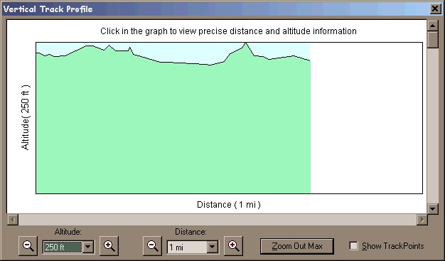 elevation profile -
250' scale
elevation profile -
250' scale